
Connecting Students to Nature through Meaningful Science Projects
Are you an educator who likes to connect students with nature? Are you looking for ways to engage them in meaningful science? Do you currently use citizen or participatory science in your education setting? If you answered “yes” to any of these questions you might be interested in the Community Snow Observations (CSO) project.
Sarah Sallade
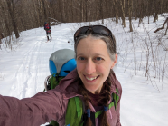
My name is Sarah Sallade and I’m an ambassador for CSO and an educator that has worked in a wide variety of settings around New Hampshire and Vermont: camp, Girl Scouts, 4-H, public school, private school and homeschool. I have also developed curriculum for the GLOBE program and am a strong advocate for participatory science as a method for engaging in high quality science & math education. I am here to share with you that this project couldn’t be easier and it is a great way to get children outside in the winter doing meaningful work.
 Community Snow Observations is a project that is run out of the University of Oregon, with a science team that collaborates with a lot of other scientists and ambassadors across the country and around the world. The primary goal of the project is to increase snowpack depth data collection across the landscape so that we have enough data feed into computer models that can then predict microscale changes in snowpack throughout the season and over the years. This kind of data is needed to understand a variety of topics scientists are interested in, including when and where water is available in the spring and summer months, how climate change is impacting snow cover, how snow depth and extent changes are impacting flora and fauna at different elevations from mountain tops down to the valleys.
While we have many weather stations that can measure precipitation data including snow, these stations are at fixed points in the landscape. The CSO project instead asks snow “users” including snowmobilers, backcountry skiers, snowshoers, and winter hikers to measure snow depth while they are out recreating. When the project started data collection focused on what was beyond the everyday activities of most people, but as the project has continued, science researchers in New England have found that more data is better, even if it is on local walking trails and areas closer to buildings, as long as it is collected correctly. This means that any person or group can measure snowpack depth data in their community, and this includes young people at school, youth development programs, and environmental education centers.
Another great aspect of this project is the accessibility of the data:
- Download the data: Community Snow Observations Snow Data
- View the data in map form: Mountain Snow Maps
How to Get Started
To participate you need:
- A sturdy measuring device that can break through snow layers to reach the ground, such as a metal meter stick or avalanche probe.
- A smartphone or tablet with the SnowScope App installed.
- 5 minutes of time.

The process is simple:
- Go outside and find an area of undisturbed snow.
- Make 3 snowpack depth measurements in centimeters within a 1-2 meter area.
- Find the mean value of the measurements.
- Enter the value into the SnowScope App at your current location.
How often you measure is your choice:
- Once
- Everyday you frequent the same location
- Measure at multiple locations on a trail that you are moving along
Explore Additional Resources for Snow Data and Education
